To the page “Scientific works”
Prof. Dr. S.V. Zagraevsky
Historical topography of Pre-Mongol Bogolyubovo
Moscow,2017.
S. V. Zagraevsky (C) 2017
Annotation
In 2017 Prof. Zagraevsky conducted the studies to define the boundaries of fortifications of pre-Mongol city Bogolyubovo. These studies showed that this city was one of the largest not only in North-Eastern Russia, but by all-Russian standards. The total length of its fortifications was about 3.4 km, the external perimeter - 2.9 km. The city had the white stone citadel, which included the white stone palace-temple complex ("the castle") of Prince Andrei Bogolyubsky.
Attention!
The following text was translated from the Russian original by the computer program
and has not yet been edited.
So it can be used only for general introduction.
What was founded in 1158 year Prince Andrew Bogolyubsky pre-Mongol city of Bogolyubovo, located in place of the modern homonymous village, Suzdal district of Vladimir the area was "full" city, not a small country Prince castle, the author of this study has repeatedly shown1. In special research work the author showed that Bogolyubovo, Prince Andrew it was the capital of North-Eastern Russia2.
However, true the magnitude of the pre-Mongol city hierarchy, until recently, remained unclear, as the researchers were aware only of the outline of the Western part its white stone and earthworks shown on the plan N. N. Voronina3 (Il. 1). What was form the Eastern part of these fortifications was known, and when the author this study wrote about the fact that the total perimeter of the fortress city estimated to be about 1.2–1.5 km4 he proceeded only from indicative of the continuation of the North line of the shafts in the direction of the ravine located to the East of the modern monastery. The question of whether city any other fortifications, had never been raised.
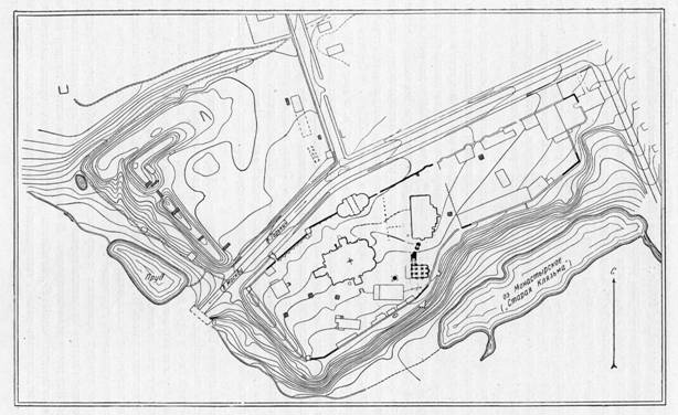
Il. 1. The plan of the ancient part of the modern village of Bogolyubovo ( N. N. Voronin).
In the spring and summer of 2017 the author conducted research designed to clarify the outlines of the Bogoliubov fortifications. The results of these studies are shown on the map attached to the scheme of the modern area, and satellite photos as of April2017.5 (Il. 2).
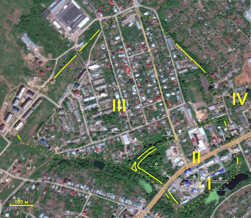
Il. 2. Map of the fortifications of the pre-Mongol Bogolyubovo.
Roman numerals on the map:
I – white-stone Palace-temple complex Andrew Bogolyubsky ("lock");
II – part city with white stone and earthen fortifications (the citadel);
III – part city with wooden-earth fortifications (fortified Posad);
IV – bargaining.
Solid lines are preserved fortifications dotted – reconstructed.
To make the most of fully and clearly to comment on this map, here is it again (Il. 3), designating it in Arabic numerals comment sections of the fortifications.
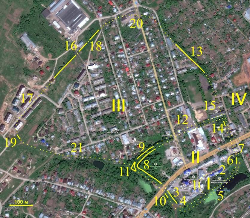
Il. 3. Map of the fortifications of the pre-Mongol Bogolyubovo with the designation of the commented sections.
1. The area in front of the Palace-temple complex ("lock") of Prince Andrei Bogolyubsky and the remaining part of the "castle" while he was the Western line it fortifications (author's graphic reconstruction of the6 given in the Il. 4).
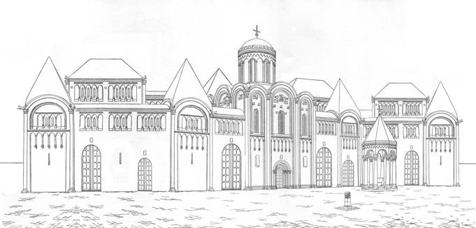
Il. 4. Bogolyubovo Palace-temple complex and the area in front of him. The view from the West. The author's reconstruction.
Architectural the history of this "castle" is dedicated to a number of scientific papers the author of this article7, here again, a thorough review of the question does not make sense. In the context of this study will note only that the remaining part of the "castle" allow we confidently judge the location of the Western edge of its fortifications.
2. The North and East the edge of the fortifications of the Prince's "castle". Their location in the absence of new archaeological data is impossible to reconstruct8, so they shown only roughly. "Castle" can take, and a lot more the territory up to the Eastern corner of the city fortifications (see review 6).
3. The line of fortifications along modern Western monastery wall. It can be by far the reconstructed on the basis of their regular shape, and of mental continue the line of preserved ramparts (see Il. 1 and comment 7). Excavations N. N. Voronin showed that this line of fortifications was white stone the walls and towers9.
4. The southern corner of the fortifications. Here the line of the modern monastery wall moves far enough away from the edge the cliff above the Klyazma, and this leads to the conclusion that fortifications was not on the line of the wall, and on the edge of the precipice. This is confirmed correct the form of this edge close to the corner, and that otherwise the South complex additions to the Church of the Nativity of the virgin (see Il. 4) had no place to stay.
5. The line of fortifications along Klyazma. This line was subjected to heavy landslides (this is confirmed by the fact that the Church of the Nativity strongly settled in the direction of the slope10) and at the present time can be reconstructed on the basis of its coupling with the fillets South (see review 4) and the East (see review 6) the corners of the fortress.
6. East corner fortifications (Il. 5). Preserved in the form of a small promontory, on which stands the corner the monastery wall shown on the plan N. N. Voronin (see Il. 1). Between between this headland and the Monastery pond (Bayou Klyazma) is a large flat land, i.e. erosion of the tip of fortifications Klyazma unlikely.
Il. 5. East corner of the fortifications (under the monastery wall).
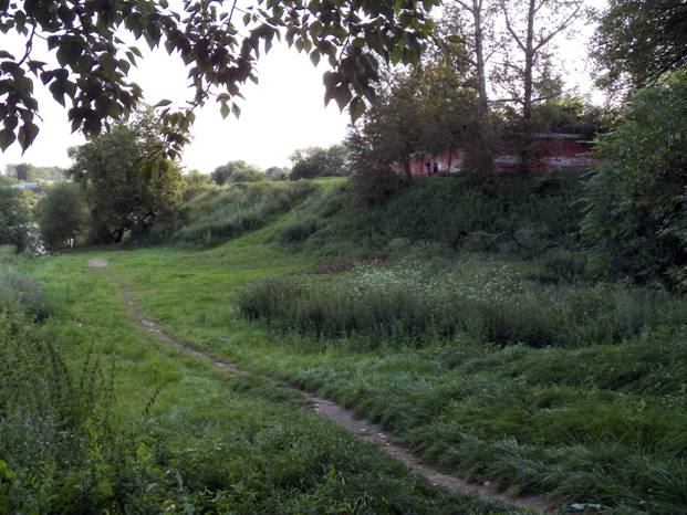
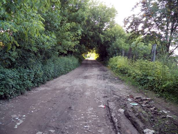
7. The beginning is almost straight line of fortifications, continuing far to the North (see comments 11 and 16). The straightness of this line is additional confirmation of the fact that the Eastern the angle of the fortifications are preserved (see comment 6). Before modern Lenin street this line and the ravine is blocked by posypkami for the construction of a large brick the building of the late XIX century, which now houses the pilgrim service of the monastery.
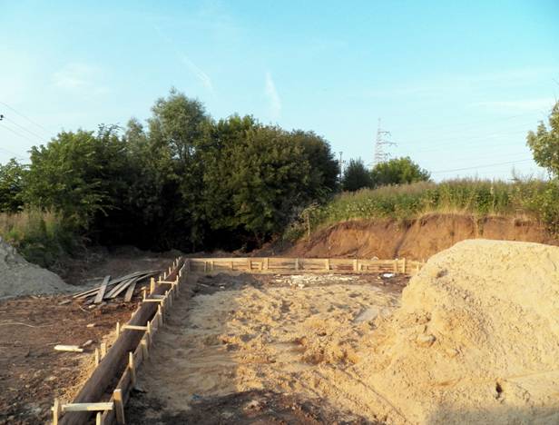
8. Formerly known researchers and indicated on the plan N. N. Voronin (Il. 1) fragments of shafts forming the angle, previously considered the most Western point of the city. Excavations N.N. Voronin found that this line of fortifications were built of white stone walls and towers. Residual the height of these shafts reaches6 m (Il. 6). In front of them from the West is a ravine with a brook – a tributary of the Klyazma river, with North – a water-filled moat.
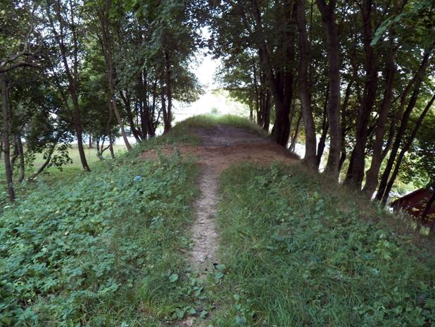
Il. 6. Val, known to researchers previously. The view from the surviving corner of the fortifications on the South-East.
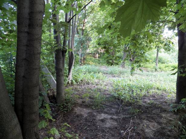
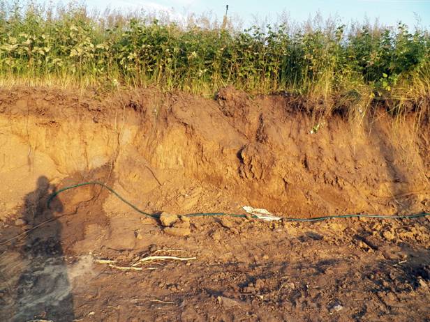
9. Preserved terraced ledge width of about10 m between the ramparts and ditches (see Il. 1 and review 7). Probably on this ledge was another line of walls.
10. Traces of the same terraced ledge in the ravine South of the modern Lenin street (Il. 7). This we may assume that this additional line of fortifications had the perimeter of the entire part of the fortress, marked on the mud. 2 the Roman numeral II.
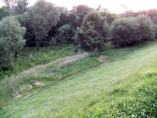
Il. 7. Traces of the terraced ledge in the ravine under the West the monastery wall.
11. Artificial island (Il. 8). The ramparts and terraces in front of them (see comments 8 and 9) in this place form an almost right angle, and here immediately under the angle of the shafts were dug flow straightener duct, partially shown in the Il. 1. Why this duct, formed at a corner of the fortifications artificial island – you can only conjecture. This could be due to the necessity of removing excess water from the pit during spring flood periods, and with the need to create a stand-alone strengthening.
Il. 8. The view from the surviving angle shafts on the guide vane duct and artificial island.
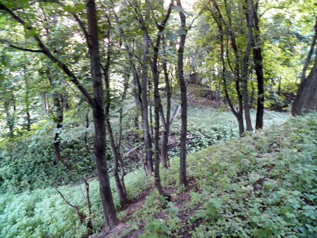
12. Continuation of the famous earlier (see comment 8) line of fortifications. If due to the dense development before it was unclear how far she came in the North-East, but now, when we know the location of the southern and Eastern lines of fortifications, we may to reconstruct, on the basis of the most probable directions – about parallel to the southern line, adjacent to East at a right angle.
13. Preserved almost straight shaft, which passes through a nameless dead-end passage (Il. 9). The present height of the shaft is 1.5–2 m, and located he doesn't have a moat and over the precipice. The height of the cliff – about5 mand it is plain facing to the Nerl (on this plain probably was a bargain). Most likely, an open in this the place has always been, and the ancient builders only had to give it the correct form.
Il. 9. Unnamed dead-end passage on the place of ramparts. The view to the North.
14. Barely surviving the visible remains of the moat (in the form of an elongated indentations about1 m) on the edge of the yard Bogoliubov school (Il. 10). They could be mistaken for natural deepening, if they are not lying on almost a straight line between preserved fragments of fortifications (see comments 7 and 13).
Il. 10. The remains of a moat on the edge of the schoolyard.
15. Unpreserved ( with the exception noted in comment 14 the remainder of the ditch) the line of fortifications which we can confidently reconstruct, based on the above in the comments 7, 13 and 14.
16. Preserved almost straight sections of the fortifications, consisting of low (not more than1 m) shafts over well traced the remains of ditches (Il. 11). In this place of natural plateau sharply decreases to the Northwest (elevation is about2 m), and, apparently, with the construction of the fortifications was made not only straightening the edge of the plateau, but its terracing.
Il. 11. The remnants of a shaft and a moat. View North-East from the extreme home about residential complex "Holy".
17. Part of the fortifications, razed in 2015-2017 in the construction of residential complex "Holy". In the section of the rampart on the Eastern edge of the residential complex (Il. 12) it is seen that this shaft it represents the crust of the soil, that along with it almost straight the direction confirms that it was a fortification, not random natural phenomenon.
Il. 12. The section of the rampart from the North-East side of the LCD Svyatovo.
18. Portion of the shaft, razed at the beginning of the summer2017. the construction of a small building of unknown purpose (Il. 13). In the context of the shaft (Il. 14) also shows that it represents the crust of the soil, not natural phenomenon.
Il. 13. Portion of the shaft, when the hidden beginning of the summer2017. construction of a small building. The view to the North-East. You can see the continuation of the ramparts and ditches (under trees).
Il. 14. Cut the shaft during the construction of the specified of the building.
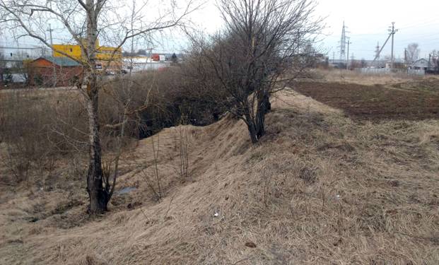
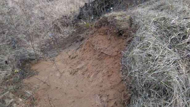
19. Visible on the ground West corner of the fortifications. The moat is filled up, the shaft has disappeared, but left a rounded terrace shape with a height of 1-2 m (Il. 15). Since this angle is in the wasteland, immediately adjacent to the LCD Svyatovo, probably soon disappear. And in General, if the construction in this area will continue, we can predict near total disappearance of the North-Western line of the fortifications of Bogolyubovo.
Il. 15. West corner of the fortifications (shown as a line with a slight slope from left to right on the background of the photo, starting from the extreme of the residential complex "Holy").
20. The Northern corner of the fortifications completely hidden under residential buildings, industrial facilities and turn the building Factory.
21. Approximately the reconstructed line of fortifications (partially blurred, partially hidden under buildings and orchards) over the cliff to the Creek – tributary of the Klyazma.
To summarize. Far from the confluence of the Klyazma and the Nerl in pre-Mongol times was a large and great (at least according to ancient standards), fortified town. The total length of its fortifications, not counting the Palace-temple complex of the Prince Andrew was about3,4 km including part of the city, which had a white stone strengthening –1.4 km. The length of the outer circuit of fortifications made2.9 km. For comparison: length shafts of Pereslavl-Zalessky – about2.5 km, Yuriev-Polsky –2 km, Suzdal –1.4 kmDmitrov, Yaroslavl (Wooden town) and Przemysl Moscow – about1 km, Zvenigorod and Moscow (the fortress in 1156) – about800 m. In North-Eastern Russia more Bogolyubov was only Vladimir: the outer perimeter of its pre-Mongol fortifications was about 5.6 km11.
Very a large city was Bogolubovo and all-Russian standards: the perimeter of the ramparts of Kiev (city of Yaroslav) – about3,5 km, Smolensk (city of Rostislav) is about the same. The perimeter of the fortifications of Pereyaslavl-Russian (now Pereyaslav-Khmelnytsky) were much less than about1.5 km, Novgorod and Staraya Ryazan (now Pereslavl-Ryazan) – about1.4 km.
Stone had no fortifications at all none of the pre-Mongol Russian city, except for a small the fortress of Ladoga in the Novgorod land. Now that we know what's out there stone fortifications of Bogolyubovo took another fortification line the wood-land, we have the right to call the white stone part of the city is the citadel. This is the more true on this spot before the construction of the city of Prince Andrew was to measure Slavic settlement12.
The approaches to Bogolyubov was also well protected in the North – mound Krupica (North-East of the village a New, approximately1.5 km from the city), in the South-East – Pokrovsky the monastery at the mouth of the Nerl13 (also about1.5 km from the city), in the West – a continuous chain of fortresses that ran for several kilometers up to Vladimir (Kurmysh, sungir, ascension and Church of Constantine and Helena monastery)14.
We see the whole the fortification system, indicating the professionalism of the builders Bogolyubovo fortress. Their professionalism is evidenced by the fact that additional external line of fortifications, was conducted with floor – to- most threatened – a party stronghold (as, for example, in Moscow wall of China-Town regarding the Kremlin walls). Impressive and exceptionally effective the use of the builders of the characteristics of the terrain.
For a time Bogolyubov built a fortress yet have it fully complete for the years of the reign of Andrei Bogolyubsky or completed later when the town has already lost the capital status, we don't know. Similarly, we do not know how this the fortress was occupied, not whether it was half empty with large backup territories (like when Yuri Dolgoruky, his failed capital Pereslavl-Zalesskiy15). Whether the walls of the citadel as a whole white stone, or the least threatened of the parties (for example, from the side of the cliff to The Klyazma or with side strengthened Posada), they still remained wood? What was the initial height of the shafts and the depth of the ditches as exactly we reconstructed their missing sections? The answers to these questions can to give only new archaeological research.
NOTES
1. Zagraevsky SV Bogoliubov architectural ensemble of the end of 1150 x – beginning 1170-ies: the history and reconstruction of // the memory of Andrei Bogolyubsky. SB. articles. Moscow – Vladimir, 2009. C. 141-167; Zagraevsky SV New the study of architectural monuments of Vladimir-Suzdal Museum-reserve. M., 2008. P. 108-129; Zagraevsky S. V. the Grand Prince's castle in Bogolyubovo: experience of graphic reconstruction. In kN.: Materials of the XVII inter-regional studies conference (April 202012.). Vol. 1. Vladimir, 2013. P. 296-312; Zagraevsky S. V. To a question about the capitals of North-Eastern Russia: Pereslavl-Zalesskiy when Yuri Dolgoruky, Bogolyubovo by Andrei Bogolyubsky // Proceedings of the XX inter-regional studies conference (April 17,2015.). Vladimir, 2016. P. 296-306.
2. Zagraevsky S. V. To a question about capitals North-Eastern Russia...
3. Voronin N. N. Architecture North-Eastern Russia XII–XV centuries. M., 1961-1962. Vol. 1. S. 201.
4. Zagraevsky SV All CIT., decree. in approx. 1 and 2.
5. Use scheme and satellite photos of "Yandex".
6. Zagraevsky S. V. the Grand Prince's castle in Bogolyubovo: the experience of the graphic reconstruction...
7. Cm. approx. 1.
8. V. K. Emelin argued that the area of Bogolyubovo Palace-temple complex was only 8 acres (V. K. Emelin Planning structure the defensive fortifications of the period of the reign of Andrei Bogolyubsky (for example Bogolyubov castle). Report on regional conference. Vladimir, 22 APR2005.), but this assertion is based on the form not the pre-Mongol, and modern slope, and the latter got its shape as a result of severe landslides (see review 5 in this article).
9. Voronin N. N. Decree. CIT. P. 204-208.
10. Ibid. S. 309.
11. Zagraevsky S. V. Historical topography of pre-Mongol Vladimir. M., 2016. GL. 1.
12. Maslov V. M. Archaeological study of Vladimir and Bogolyubovo with a 30-ies of the XIX century to the this time // Monuments of history and culture. Vol. 2. Yaroslavl, 1983. C. 15-31.
13. Zagraevsky S. V. early the history of the Pokrovsky monastery on the Nerl // proceedings of the XXI inter-regional studies conference (18 APR2016.). Vladimir, 2016. P. 194-201.
14. Maslov V. M. Decree. Op.
15. Zagraevsky S. V. To a question about capitals North-Eastern Russia...
© Sergey Zagraevsky
To the page “Scientific works”